
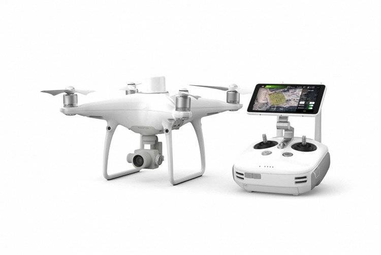
DJI Phantom 4 RTK + D-RTK 2 Mobile Station Combo

Excellent mapping
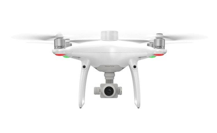
The DJI Phantom 4 RTK is a quadrocopter from the popular Phantom series. It is the first representative of its segment DJI Enterprise. All thanks to the RTK module - a positioning system with centimetre accuracy, which makes DJI's new product the most compact device for mapping terrain at low altitude.
High-quality positioning system
The new RTK module is directly integrated into the Phantom 4 RTK, providing real-time positioning data with centimetre accuracy to improve the accuracy of image metadata. Just below the RTK receiver is a GNSS module, installed to maintain flight stability in terrain with poor signal quality, such as heavily populated cities. The combination of these two modules allows the Phantom 4 RTK to optimise flight safety while collecting precise data for surveying, terrain mapping and inspection purposes.
In addition, the Phantom 4 RTK is adaptable to any task thanks to several connection options:
- Connection to the D-RTK 2 Mobile Station positioning system (available separately)
- Connection to a network of reference stations, using NTRIP (transport of the RTCM standard via Internet Protocol) via a 4G dongle or WiFi hotspot
- Storage of satellite observation data for subsequent use in Post Processed Kinematics (PPK)
TimeSync
To take full advantage of the Phantom 4 RTK positioning modules, TimeSync was created - a new system designed to set the real-time position of the flight controller, camera and RTK module. Additionally, TimeSync ensures that the most accurate image metadata is used and corrects the positioning data at the centre of the sensor - optimising the results for centimetre-accurate positioning data.
High-precision sensor
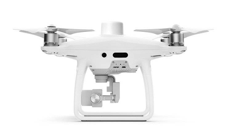
The Phantom 4 RTK has a 1-inch, 20 megapixel CMOS sensor. The mechanical shutter allows for terrain mapping without visible seams - images are free of rolling shutter. Thanks to its high resolution, the Phantom 4 RTK can achieve a terrain pixel size (GSD) of 2.74 cm at 100 metres. To ensure unprecedented accuracy, each unit undergoes a rigorous calibration process during which optical distortion is measured. Distortion parameters are stored and saved in the metadata of each image, allowing the processing software to tailor the image to the requirements of the specific customer.
Dedicated flight planning application
The new Ground Station RTK app allows operators to intelligently control the Phantom 4 RTK using two modes - Photogrammetry mode and Waypoint Flight mode. The flight planning modes provide the ability to select a flight path while determining image overlap, altitude and airspeed, camera parameters and more. The application has an option to directly load KML files for flight planning while still in the office. Also new are a shutter priority mode to keep exposure values constant across all images, and a high wind alert to warn the operator of flying in adverse conditions.
Mobile SDK
The Phantom 4 RTK is compatible with the Mobile SDK software development toolkit, making it possible to automate and personalise functions via a mobile device.
Transmission system OcuSync
The OcuSync transmission system used in the Phantom 4 RTK allows for stable and reliable image transmission with a range of up to 5 km (in interference-free terrain, CE).
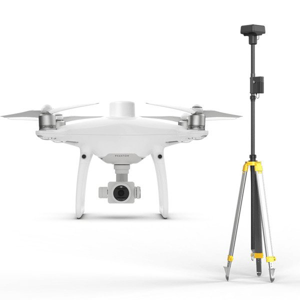
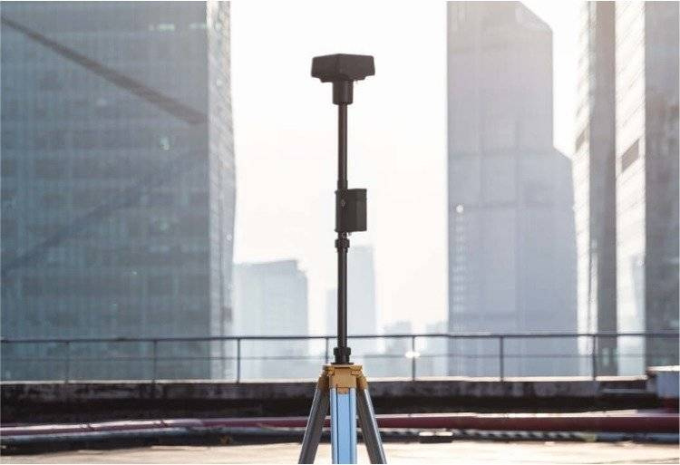
Compatibility with mobile station D-RTK 2
Thanks to new developments, the Phantom 4 RTK can be combined with the D-RTK 2 mobile station to provide real-time data and high accuracy. The mobile station, together with OcuSync 2.0, allows you to obtain accurate measurements to the nearest centimetre in all conditions.
Included
| Phantom 4 RTK |
|---|
| Control apparatus |
| Four pairs of propellers |
| Charger with AC cable |
| 5870 mAh battery - 2 pieces |
| Rechargeable battery for apparatus |
| Charging hub for 3 batteries |
| Charging hub for 2 rechargeable batteries |
| Gimbal lock |
| MicroSD card (16 GB) |
| Transport case |
| Kabel Micro USB |
| Dongle |
| USB-C OTG cable |
| USB-C cable |
Specification
GENERAL
| Starting mass | 1391 g |
|---|---|
| Diagonal | 350 mm |
| Max. ceiling above sea level | 6000 m |
| Max. climb rate | 6 m/s (automatic flight); 5 m/s (manual control) |
| Max. falling speed | 3 m/s |
| Max. speed | 50 km/h (P-mode) 58 km/h (A-mode) |
| Max. flight time | Approx. 30 minutes |
| Operating temperature | 0° - 40℃ |
| Frequency | 2.400 GHz - 2.483 GHz |
| Transmission power (EIRP) | 2.4 GHz CE:< 20 dBm |
| Hovering accuracy | RTK enabled and functioning properly: Vertically:±0.1 m;Horizontally:±0.1 m RTK disabled: Vertically:±0.1 m(with positioning system ); ±0.5 m(with positioning GNSS) Horizontally:±0.3 m(with positioning system); ±1.5 m(with positioning GNSS) |
| Image positioning |
The position of the camera focal point depends on the centre of the built-in D-RTK antenna at a point in coordinates from the focal point (x=36, y=0, z=192 mm), this position is already superimposed on the image coordinates in the Exif data (x - forward axis, y - right axis, z - down axis). |
FUNKCJE MAPOWANIA
| Dokładność mapowania ** | Dokładność mapowania spełnia wymagania standardów dokładności ASPRS dla cyfrowych ortofotomap klasy III ** właściwa dokładność jest zależna od warunków oświetleniowych i mapowanych powierzchni, wysokości przelotu, użytego oprogramowania i innych czynników. |
|---|---|
| Terenowa wielkość piksela (GSD) | (H/36.5) cm/piksel, H: pułap w metrach w stosunku do mapowanego obiektu |
| Efektywność otrzymywania danych | Maks obszar - ok. 1 km² na jeden przelot (na wysokości 182 m, GSD ok. 5 cm/piksel, spełnione wymagania standardów dokładności ASPRS dla cyfrowych ortofotomap klasy III) |
SYSTEM POZYCJONOWANIA OPTYCZNEGO
| Dopuszczalna prędkość | ≤ 50 km/h na 2 m nad ziemią, dobre oświetlenie |
|---|---|
| Wysokość wykrycia | 0 - 10 m |
| Odległość wykrycia | 0 - 10 m |
| Zakres wykrycia przeszkód | 0.7-30 m |
| Pole widzenia (FOV) | Sensor przedni / tylny: 60° (poziomo), ±27° (pionowo) Sensor dolny: 70° (przód - tył), 50° (lewo - prawo) |
| Częstotliwość pomiaru | Sensor przedni / tylny:10 Hz; Sensor dolny: 20 Hz |
| Środowisko pracy | Powierzchnie z wyraźną fakturą, dobre oświetlenie (> 15 lux) |
KAMERA
| Sensor | 1" CMOS; Efektywne piksele: 20M |
|---|---|
| Optyka | FOV 84°;8.8 mm / 24 mm(35 mm, ekwiwalent: 24 mm); f/2.8 - f/11, auto focus at 1 m - ∞ |
| Zasięg ISO | Video:100-3200(Auto) 100-6400(Manual); Photo:100-3200(Auto) 100-12800(Manual) |
| Prędkość migawki mechanicznej | 8 - 1/2000 s |
| Prędkość migawki elektronicznej | 8 - 1/8000 s |
| Maks. rozmiar obrazu | 4864×3648(4:3); 5472×3648(3:2) |
| Nagrywanie Video | H.264,4K:3840×2160 30p |
| Format Foto | JPEG |
| Format Video | MOV |
| Obsługiwane systemy plików | FAT32(≤ 32 GB); exFAT(> 32 GB) |
| Obsługiwane karty SD | MicroSD, Maks. pojemność: 128 GB. Wymagana klasa 10 lub UHS-1, wymagana prędkość zapisu ≥15 MB/s |
| Temp. pracy | 0° - 40℃ |
AKUMULATOR (PH4-5870MAH-15.2V)
| Pojemność | 5870mAh |
|---|---|
| Napięcie | 15.2V |
| Typ baterii | LiPo 4S |
| Energia | 89.2 Wh |
| Waga | 468 g |
| Temp. ładowania | -10° - 40℃ |
| Maks. moc ładowania | 160W |
GNSS
| Pojedyncza częstotliwość, moduł GNSS | GPS+GLONASS |
|---|---|
|
Wykorzystywana częstotliwość: Pionowo 1.5 cm + 1 ppm; 1 ppm oznacza 1mm dopuszczalnego błędu za każdy km prędkości urządzenia (wartość uśredniona). |
GIMBAL
| Stabilizacja | 3-osiowa (tilt, roll, yaw) |
|---|---|
| Pitch | -90° do +30° |
| Maks. prędkość obrotu | 90°/s |
| Zakres wibracji kątowej | ±0.02° |
PODCZERWIEŃ
| Zasięg wykrycia przeszkód | 0.2 - 7 m |
|---|---|
| Pole widzenia (FOV) | 70°(poziomo) ±10°(pionowo) |
| Częstotliwość pomiaru | 10 Hz |
| Środowisko pracy | Powierzchnia odbijająca sygnał rozproszony, współczynnik odbicia > 8% (ściany, ludzie, drzewa itp.) |
APARATURA STERUJĄCA
| Częstotliwość pracy | 2.400 GHz - 2.483 GHz |
|---|---|
| Moc nadajnika (EIRP) | 2.4 GHz CE:< 20 dBm |
| Maks. zasięg transmisji | CE: 5 km (teren otwarty, wolny od zakłóceń) |
| Zapotrzebowanie na prąd | 16 W (średnio) |
| Wyświetlacz | 5.5-calowy, 1920×1080, 1000 cd/m², system operacyjny Android pamięć 4G RAM+16G ROM |
| Temp. pracy | 0° - 40℃ |
ŁADOWARKA (PH4C160)
| Napięcie | 17.4V |
|---|---|
| Moc znamionowa | 160W |
12 miesięcy
12 miesięcy
Ask a question
Write your opinion