

Guide


Pix4Dfields
Advanced agriculture mapping software for aerial crop analysis and digital farming.
 |
CaptureCollect images using a drone and any standard RGB or a selected multispectral camera like Parrot Sequoia+ and MicaSense RedEdge. Use our Pix4Dcapture app to easily plan and control your drone flight for optimal mapping. |
 |
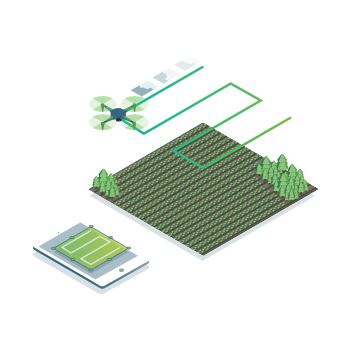
ProcessProcess imagery with the instant processing engine and get your maps directly in the field: 6.8 GB, 2948 images, 10 min (with the new radiometry module). |
 |
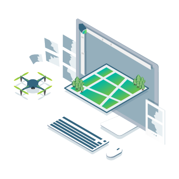
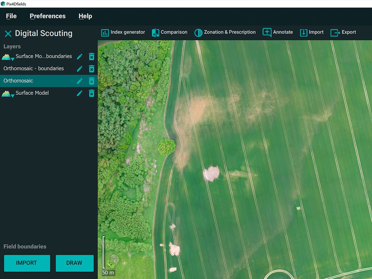
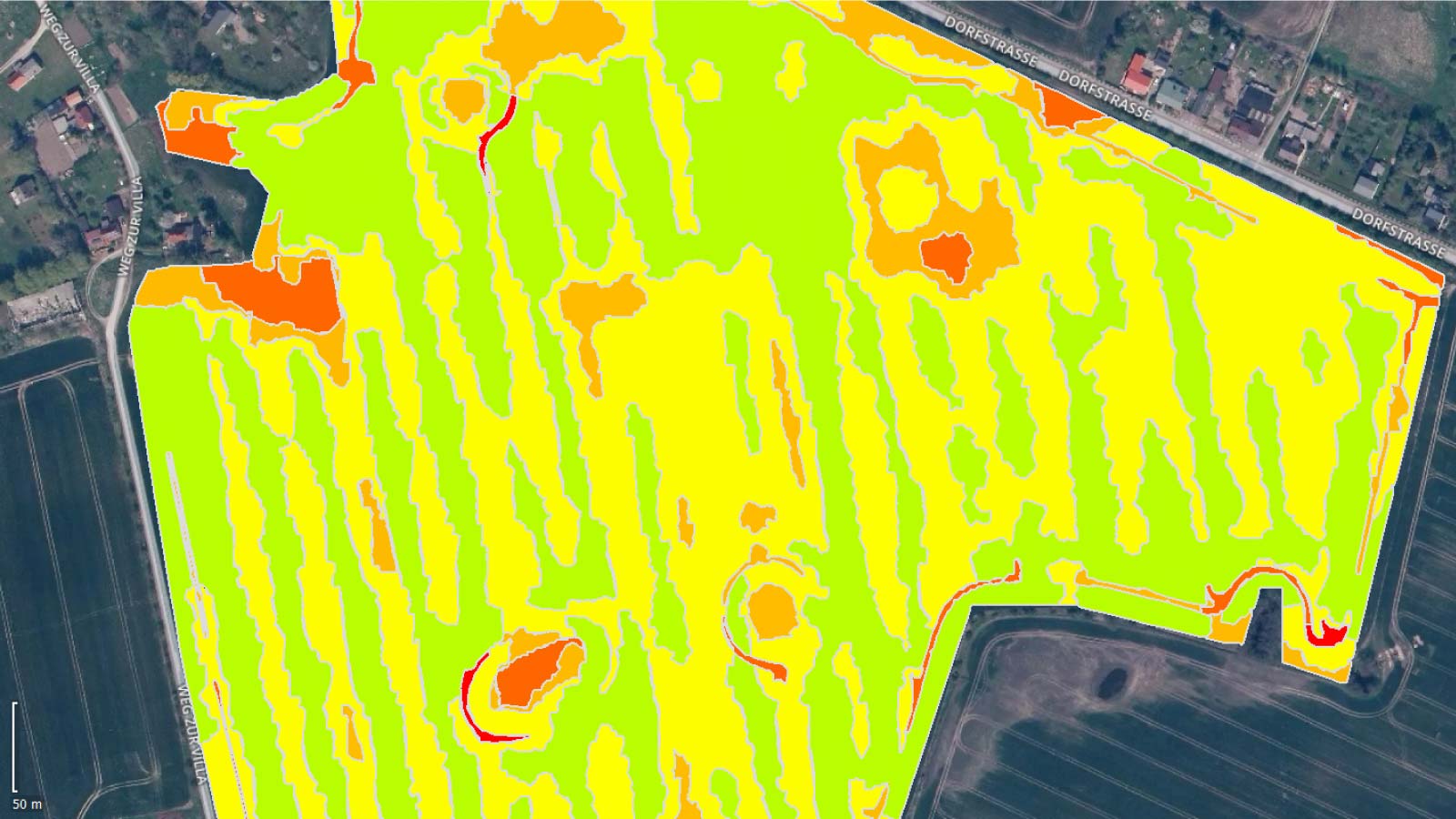
ScoutGenerate precise orthomosaics, digital surface models, index maps, zones and accurate prescription maps. Trim your fields to a desired field boundary to create more targeted outputs. |
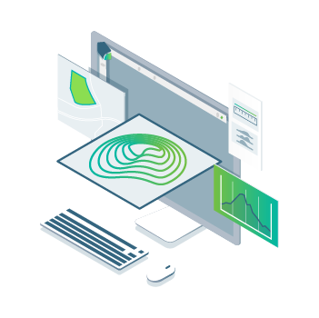 |
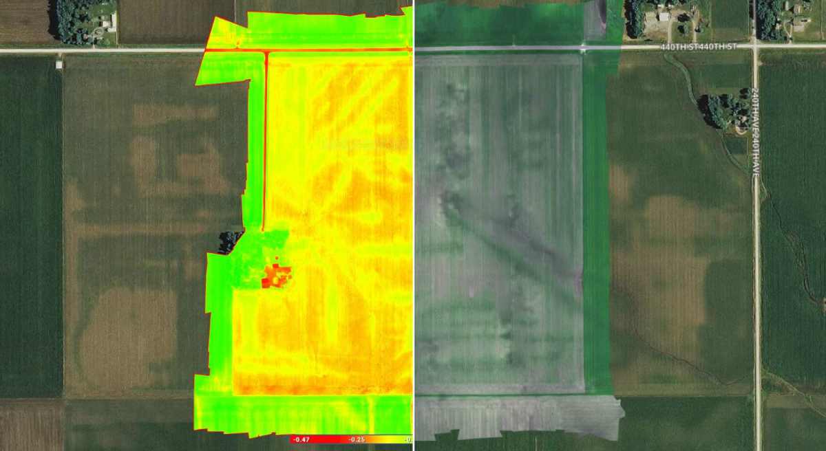
AnalyzeVisualize and understand your crop growth stages and stress levels. Analyze and compare different layers of information for a full insight of your yield performance and use them to increase crop production and reduce costs. |
 |
ShareShare your maps with all project stakeholders for seamless collaboration using Pix4Dfields PDF report tool. |
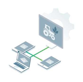 |
IntegrateDownload all outputs, results and insights and import them into the Farming Management Software of your choice in various industry standard formats. |
Dlaczego Pix4Dfields
 |
 |
 |
||
AccuracyConvert photos into consistent, easy to compare and precise 3D maps. |
ImmediacyWith the new software engine for instant data processing, you can generate and share high resolution maps in real time while working in the field. |
IntuitivenessOptimize your workflow with unique tools designed for fast and accurate mapping in agriculture and other vegetation-related industries. |
Create and analyze real time maps of your crops to enhance your agriculture workflow
Fast mapping - Process imagery with the Pix4Dfields instant processing engine and achieve results in minutes in-office and in-field. No internet required.
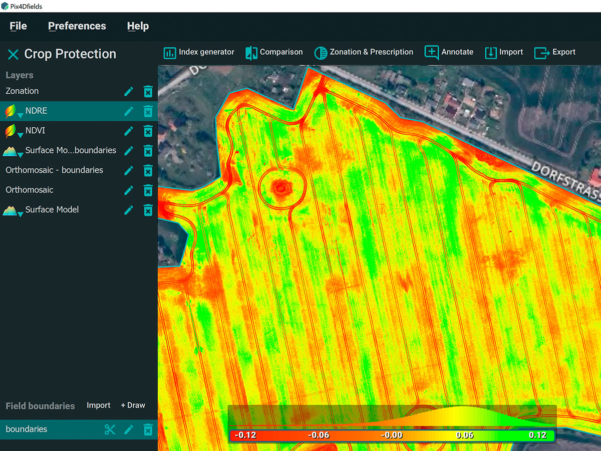
Generate indices - Use the predefined list of agricultural indices or input your own custom index formula to understand your plant stress better.
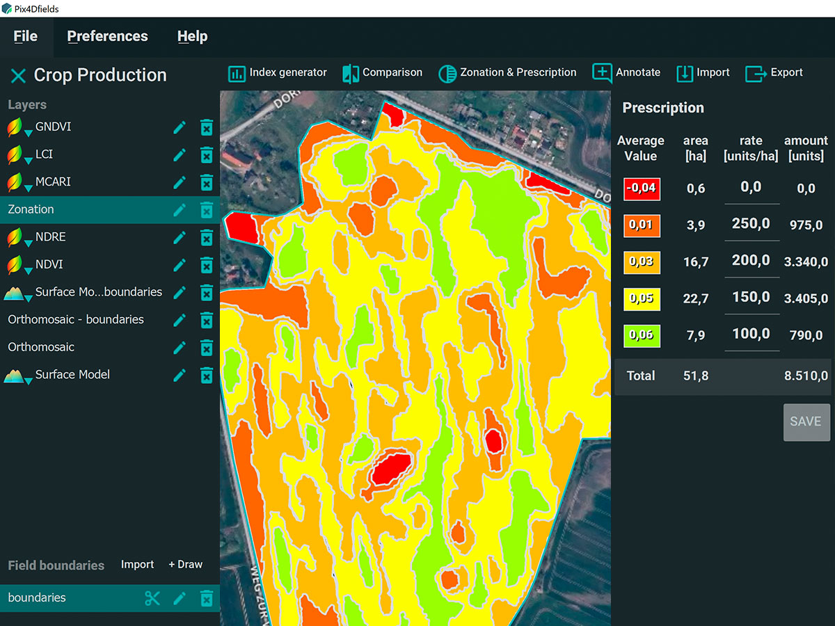
Zonate and prescribe - Aggregate the information from the vegetation index maps into zones and assign application rates.
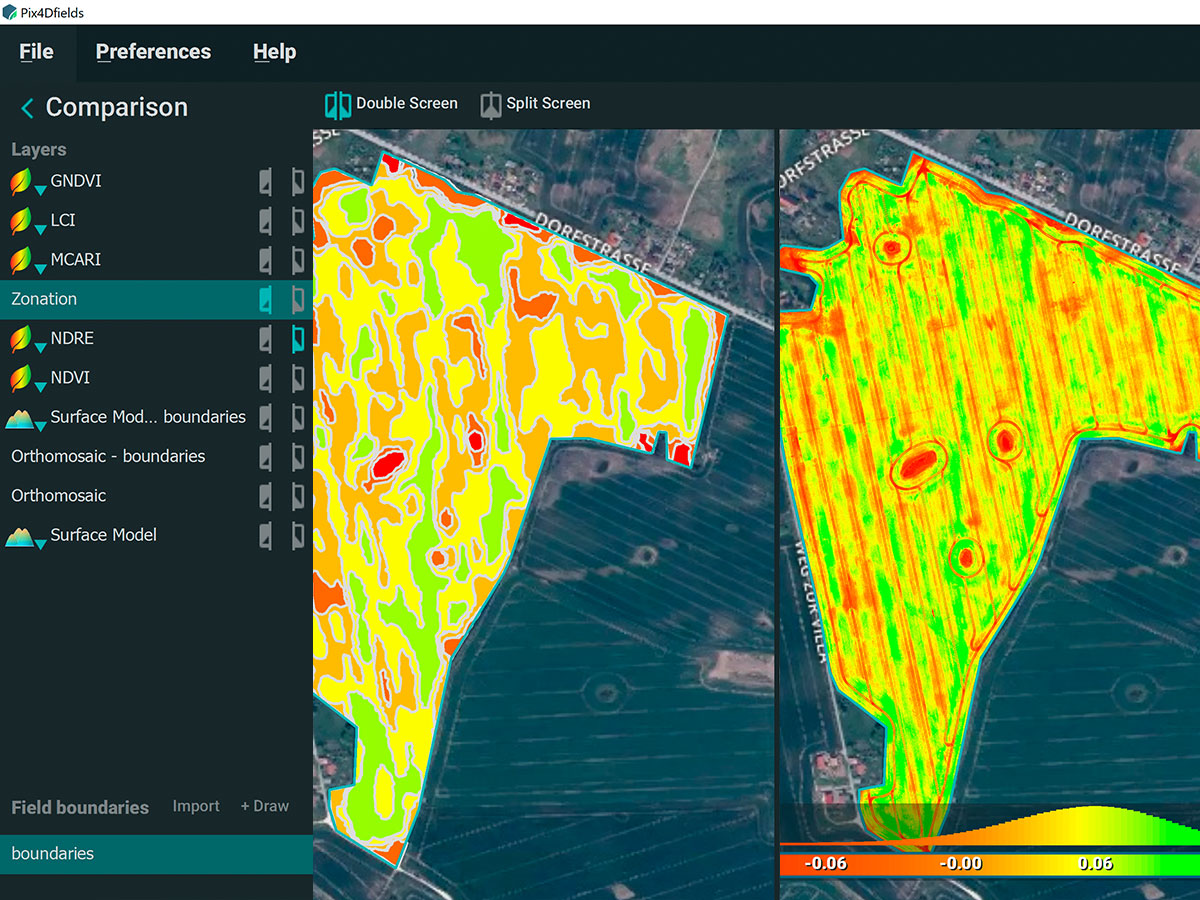
Compare - Link different layers of information and compare your crop trends over time in a split or a double screen.
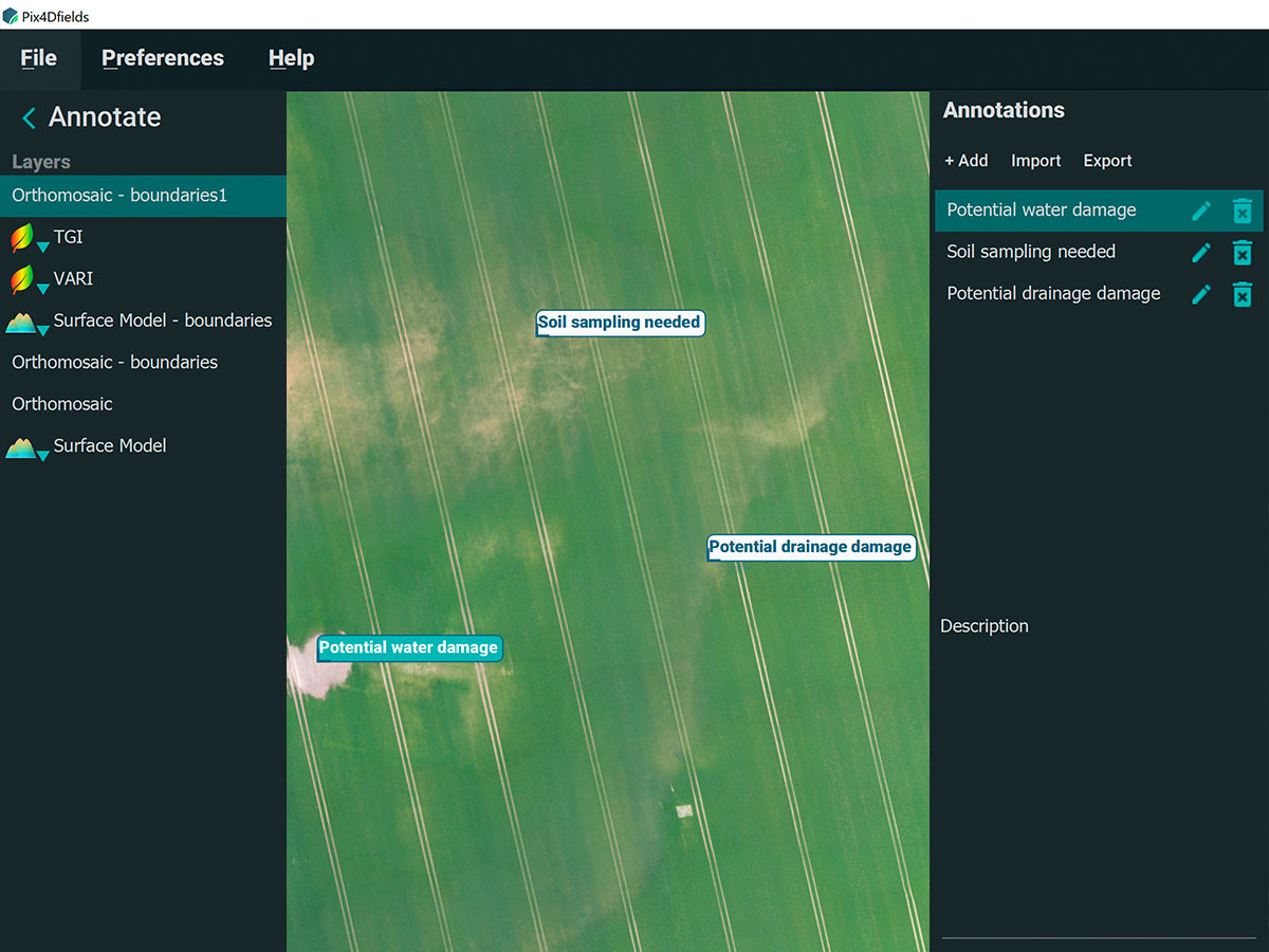
Measure and Annotate - Add annotations to and measure important farm areas.
See the invisible
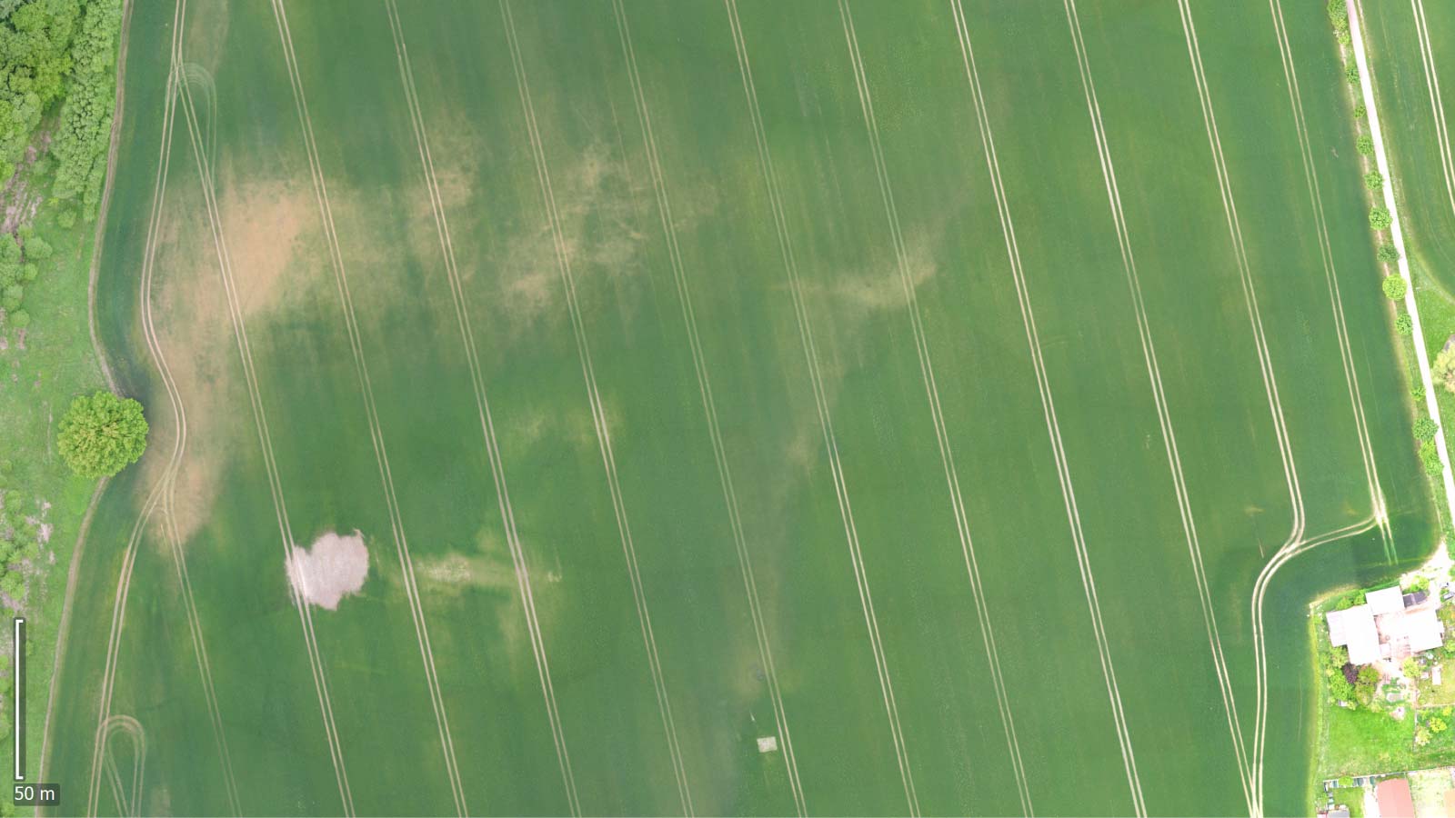
Import photos from any drone, whether RGB or multispectral
multispectral camera images
RGB images from camera drones
photos from modified cameras
pictures from other cameras
Improved workflow with a wide range of output files
Orthomosaics

Field boundaries
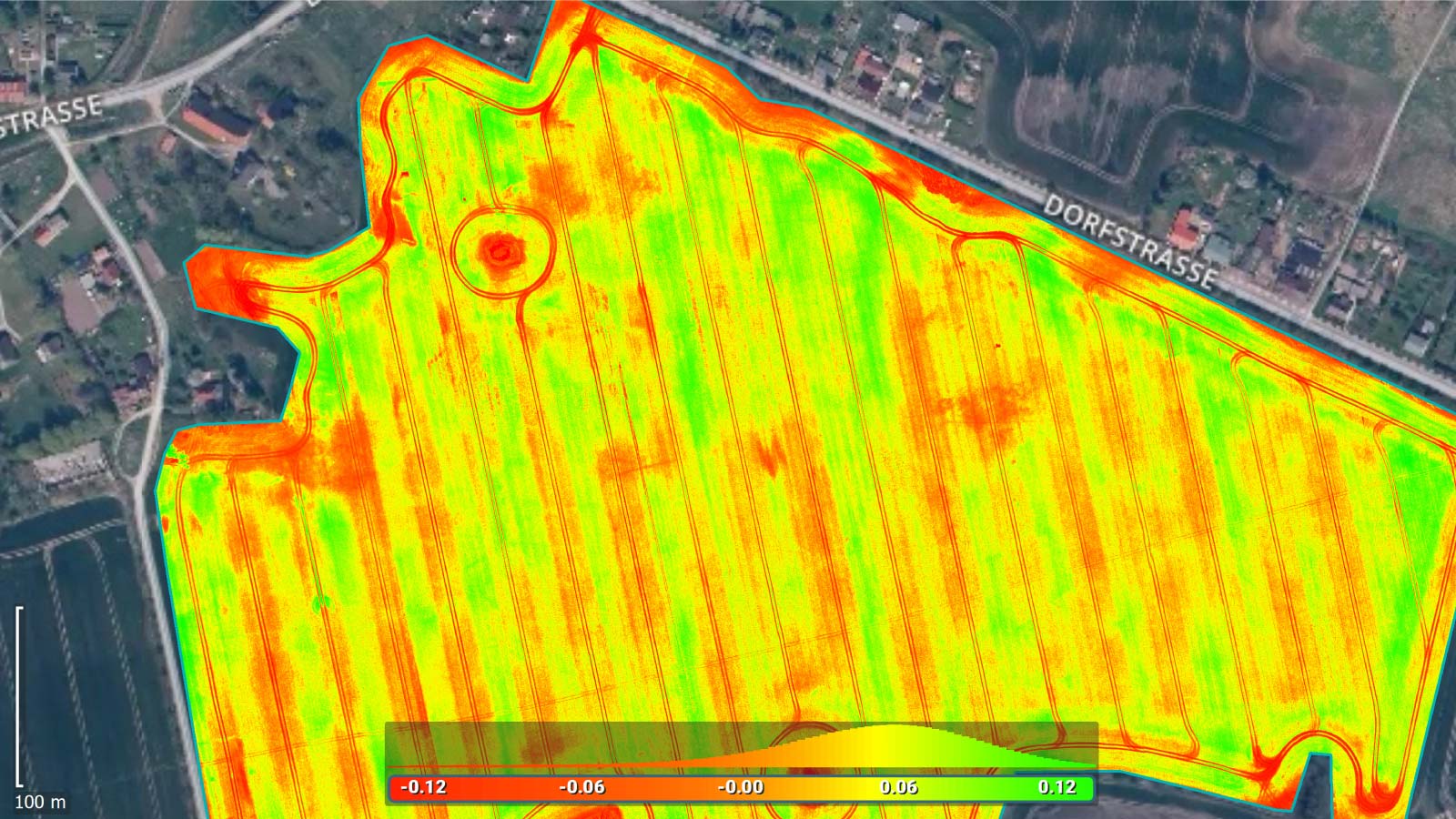
Differentiated vegetation health index maps

Digital surface models
Area map

Maps of recommendations
Superb producer support
Pix4D offers an extensive free knowledge base in the form of: publicly available instructional videos, step-by-step instructions, articles, webinars, as well as an active forum for users, and paid in-depth training and certification.
![]()