
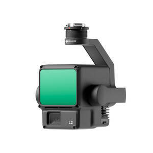
High-Precision Aerial LiDAR System DJI Zenmuse L2 + DJI Care 2 years


Powerful Range, Elevated Precision
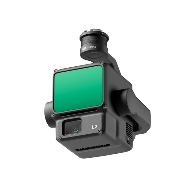
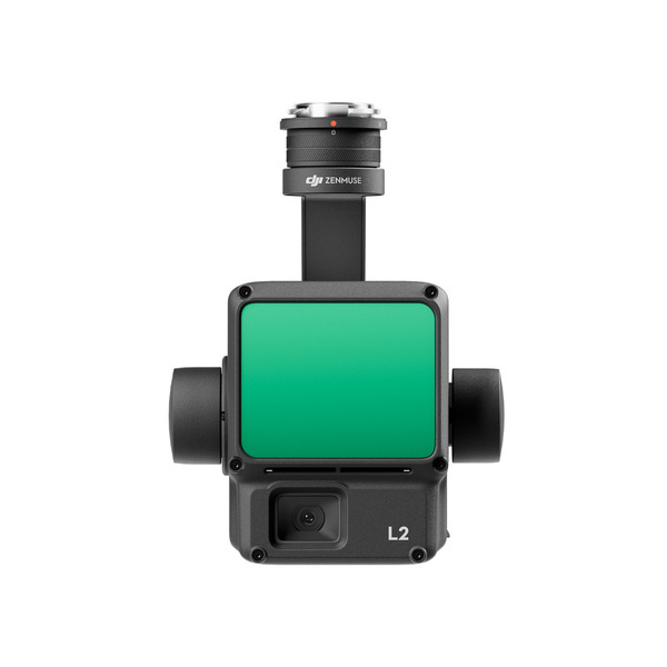
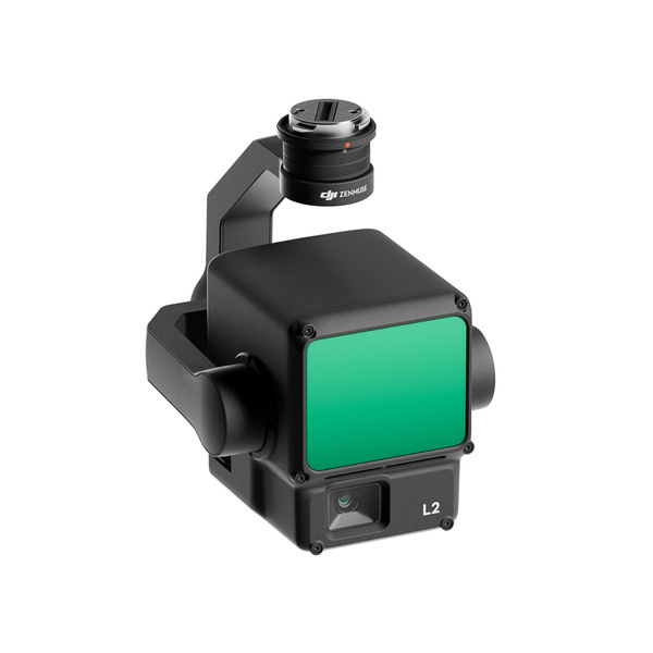
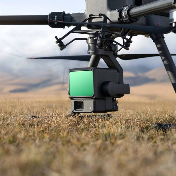
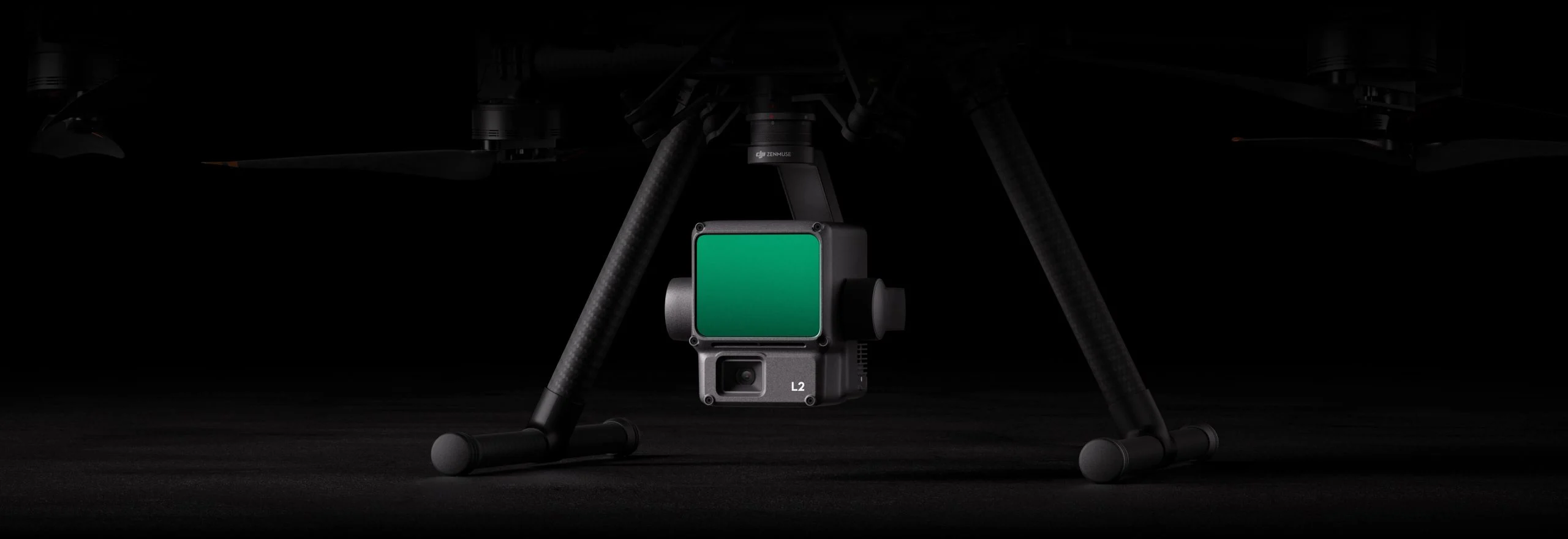
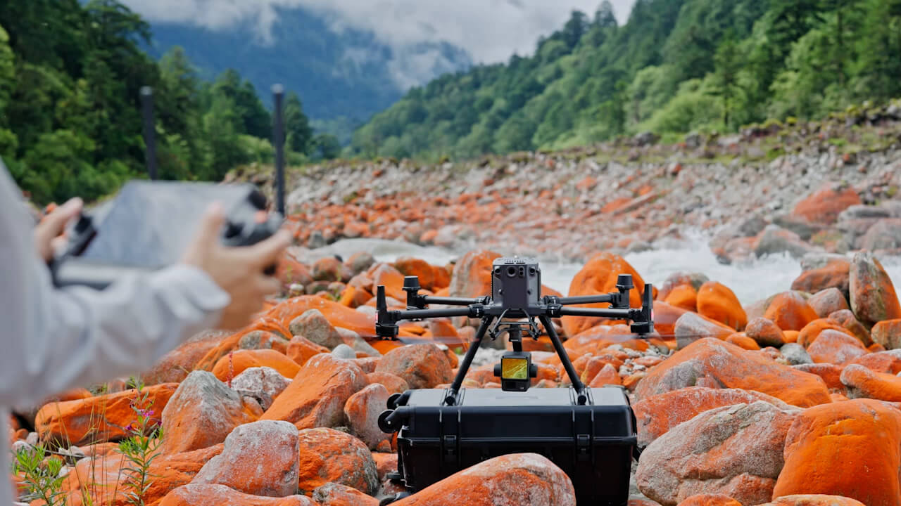
The all-new DJI Zenmuse L2 integrates frame LiDAR with a high-accuracy IMU system and a 4/3 CMOS RGB mapping camera to provide DJI flight platforms with more precise and reliable geospatial data acquisition. When paired with DJI Terra the Zenmuse L2 delivers a turnkey solution for 3D data collection and high-accuracy post-processing. Supported by its powerful hardware - the L2 can allow for a precise scan of complex subjects within an extended range and faster point cloud acquisition.
Zaawansowane rozwiązanie LiDAR
Wspierany przez zaawansowaną technologię, ładunek użytkowy Zenmuse L2 pozwala na precyzyjne skanowanie złożonych obiektów w większym obszarze i pozwalając na jeszcze szybsze tworzenie chmur punktów.
High-Level Precision
By combining GNSS and a high-accuracy self-developed IMU, the Zenmuse L2 achieves 4cm vertical accuracy and 5cm horizontal accuracy.
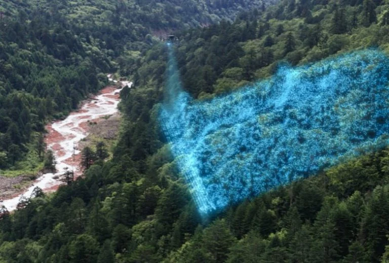
Exceptional Efficiency
It’s ready for work as soon as the Zenmuse L2 is powered on and can collect both geospatial and RGB data from a 2.5km2 area in a single flight.
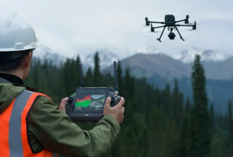
Intuitive Operation
When used with Matrice 350 RTK and DJI Terra, the Zenmuse L2 offers a turnkey solution that is simple to use, lowering the operational threshold.
30% Detection Range Increase
The Zenmuse L2 can detect from 250 meters at 10% reflectivity and 100 klx, and up to 450 meters at 50% reflectivity and 0 klx. The typical operational altitude now extends up to 120 meters, notably enhancing operational safety and efficiency.

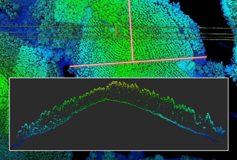
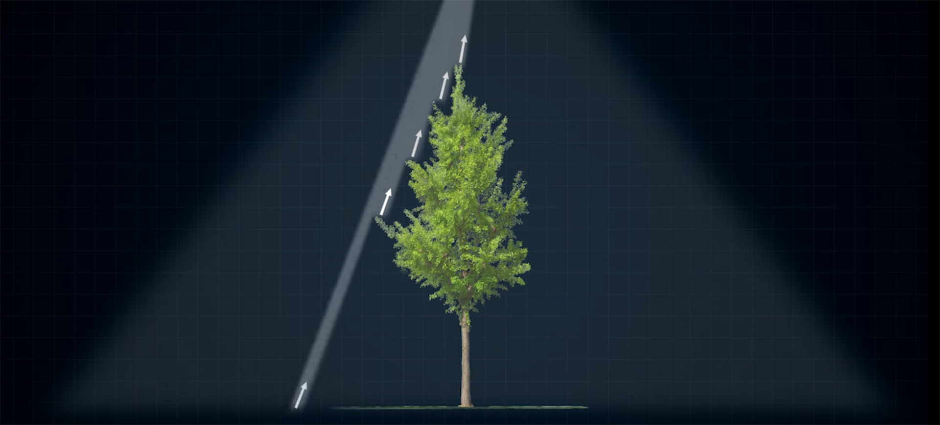
Smaller Laser Spots, Denser Point Clouds
With a reduced spot size of 4×12 cm @100m, only a fifth of that of L1, L2 not only detects smaller objects with more details, but can also penetrate denser vegetation, generating more accurate digital elevation models (DEM).
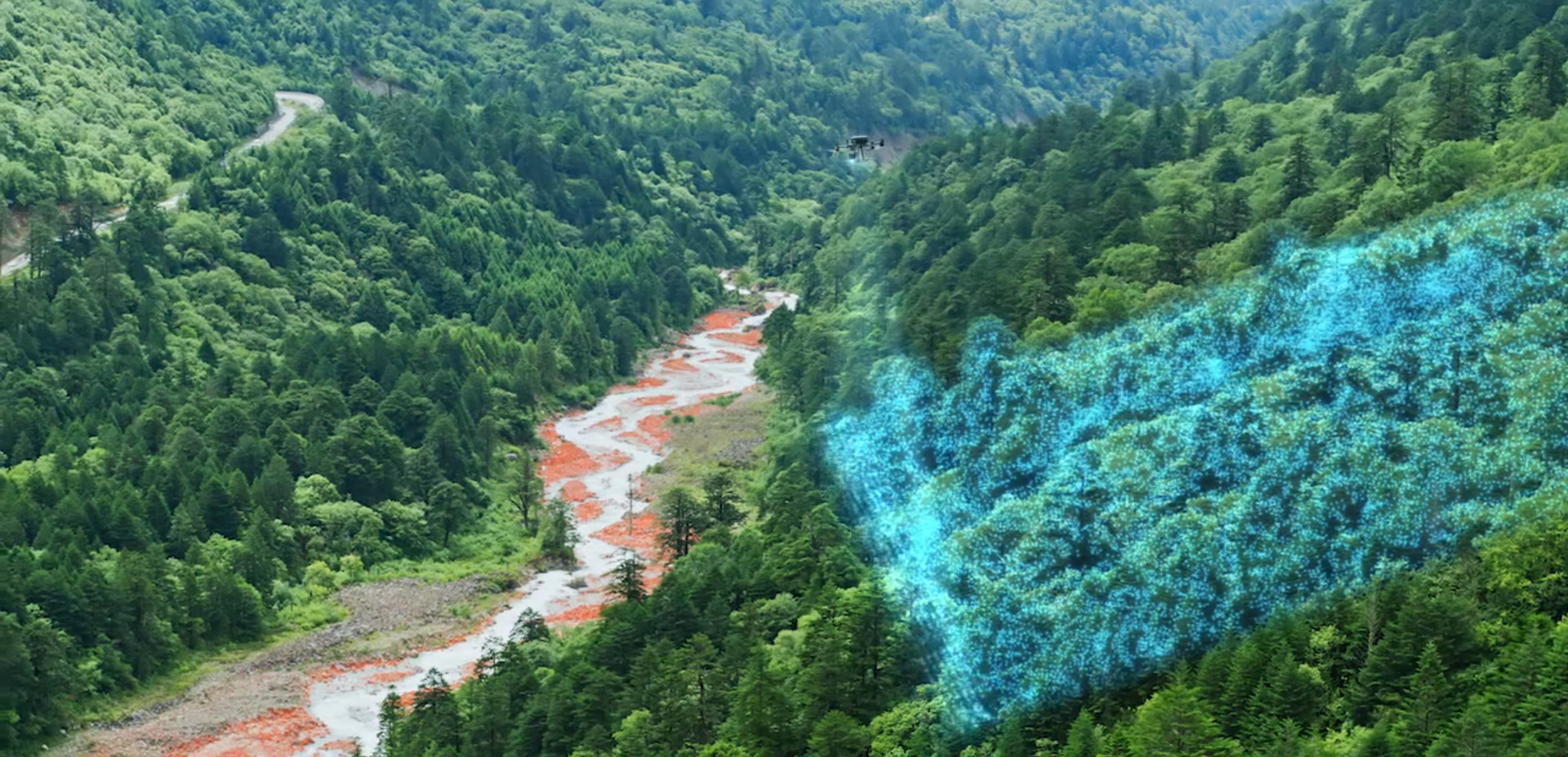
Supports 5 Returns
In densely vegetated areas, L2 can capture more ground points beneath the foliage.
Effective Point Cloud Rate: 240,000 pts/s
In both single and multiple return modes, L2 can reach a max point cloud emission rate of 240,000 points per second, allowing the acquisition of more point cloud data in a given time frame.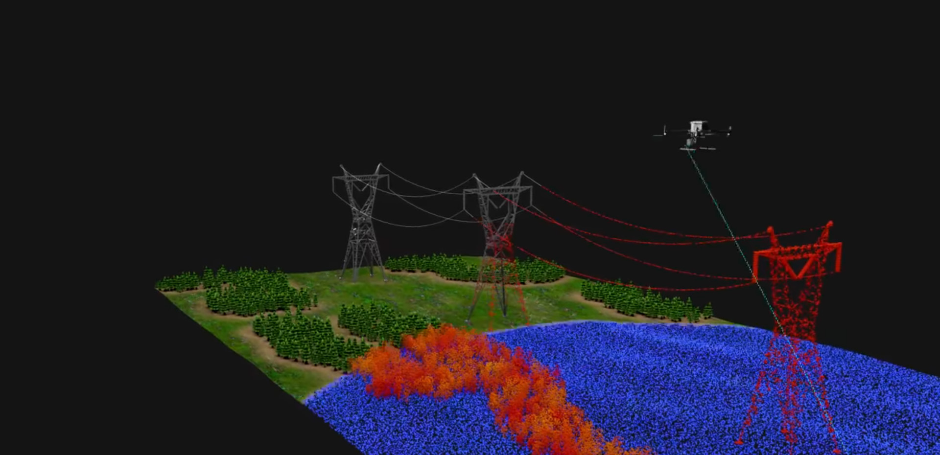
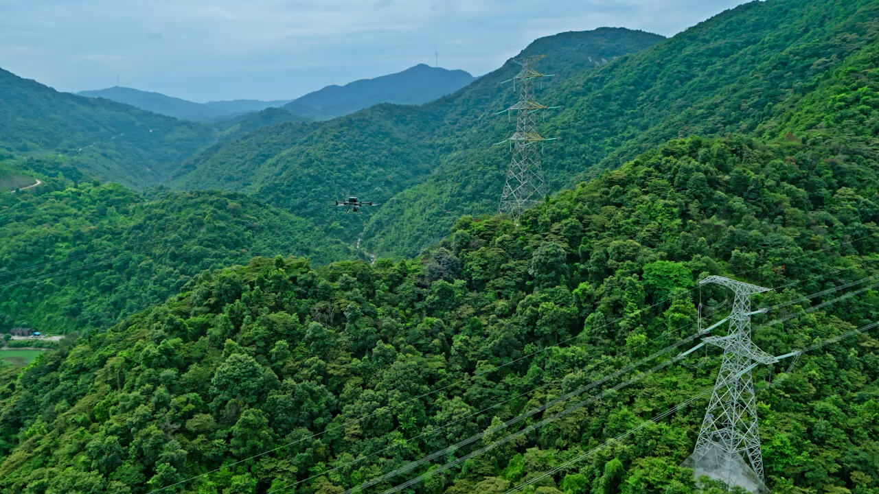
Two Scanning Modes
L2 supports two scanning modes, offering flexibility for users based on their task demands. In repetitive scanning mode, L2's LiDAR can achieve more uniform and accurate point clouds while meeting high-precision mapping requirements. In non-repetitive scanning mode, it offers deeper penetration for more structural information, making it suitable for power line inspection, forestry surveying, and other scenarios.
High-Accuracy IMU System
The high-accuracy self-developed IMU system, combined with the drone’s RTK positioning system for data fusion during post-processing, gives L2 access to highly accurate absolute position, speed, and attitude information. In addition, the IMU system’s enhanced environmental adaptability improves the operational reliability and precision of L2.
Yaw Accuracy:
Real-time: 0.2°, post-processing: 0.05°
Pitch/Roll Accuracy:
Real-time 0.05°, post-processing 0.025°
No IMU Warm-up
The performance of the IMU system has been significantly enhanced, and it is ready for use the moment it's powered on. And, the accompanying drone is ready to begin tasks immediately once the RTK is in FIX status, delivering an optimized in-the-field experience.
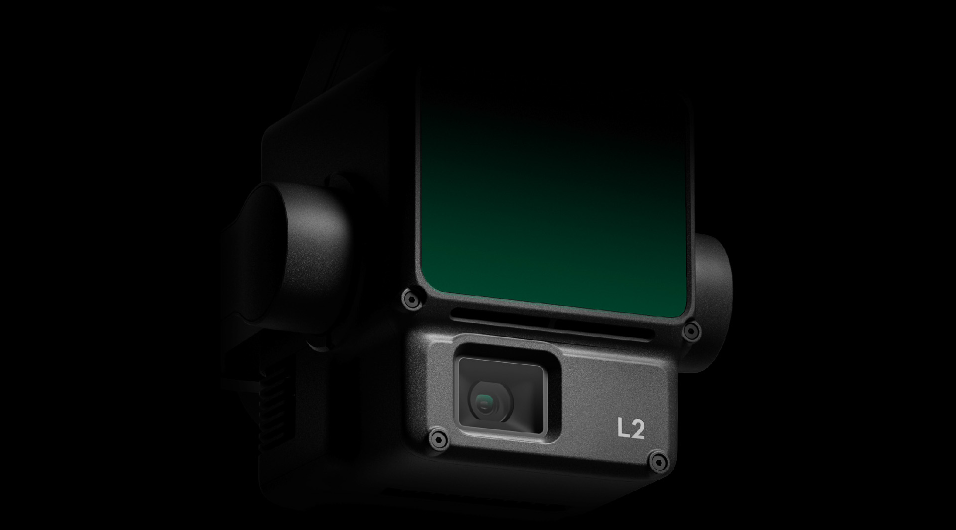
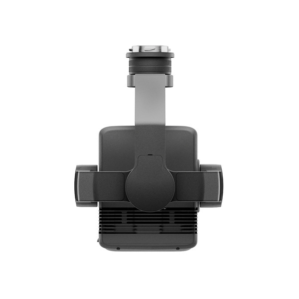
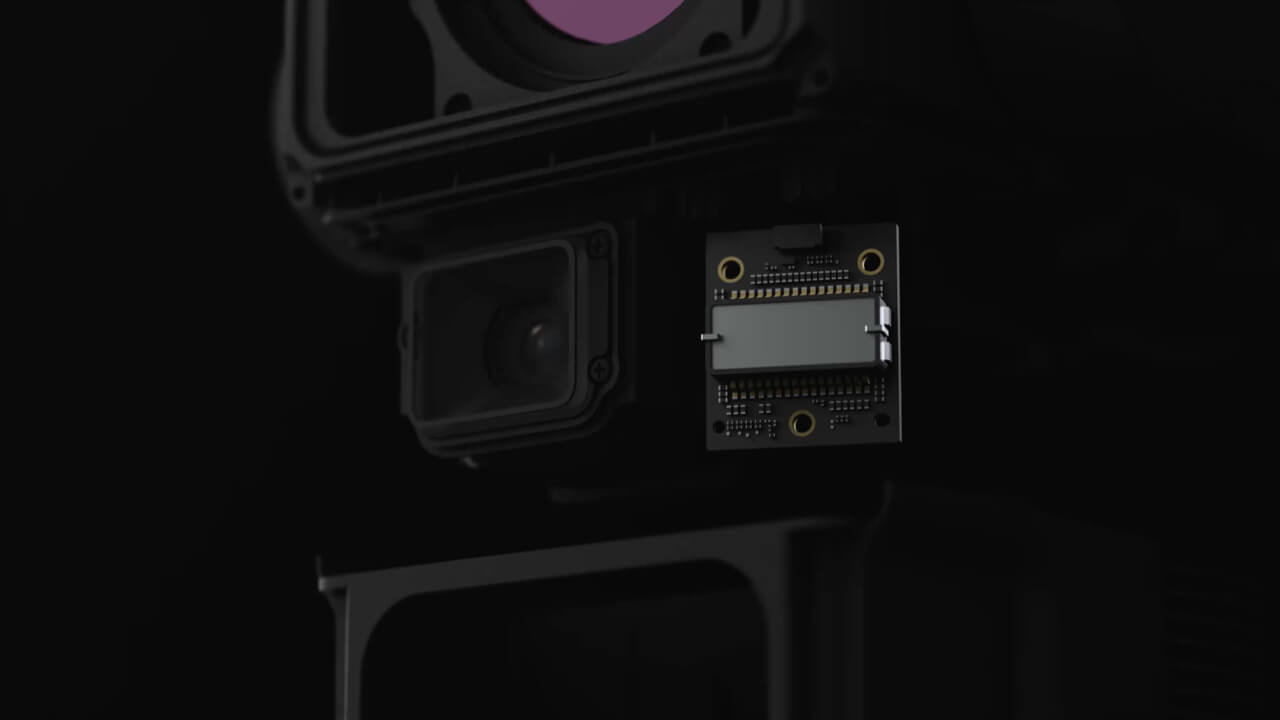
RGB Mapping Camera
Pixel size has been enlarged to 3.3 µm, and effective pixels now reach 20 MP, resulting in a significant improvement in overall imaging, as well as more enriched true-color point cloud details. The minimum photo interval has been reduced to 0.7 seconds. The mapping camera has a shutter count of up to 200,000 times, further reducing operational costs. When point cloud collection is not needed, the RGB camera can still take photos and videos, or collect images for visible light mapping.
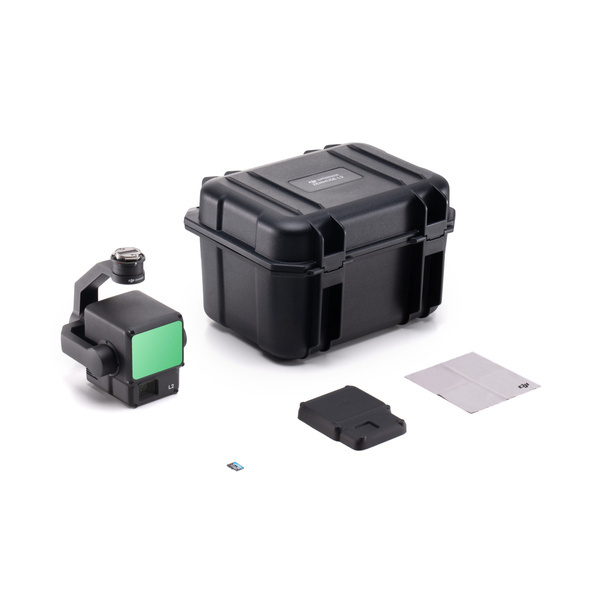
Kit contents:
- Zenmuse L2
- DJI Care Enterprise Basic for 2 years (auto activation)
- 128GB microSD memory card
- Lens hood
- Lens cleaning cloth
- Carrying case
General
-
Product Name
-
Zenmuse L2
-
Dimensions
-
155×128×176 mm (L×W×H)
-
Weight
-
905±5 g
-
Power
-
28 W (typical)
58 W (max.)
-
IP Rating
-
IP54
-
Supported Aircraft
-
Matrice 300 RTK (requires DJI RC Plus)
Matrice 350 RTK
-
Storage Temperature
-
-20° to 60° C (-4° to 140° F)
-
General Operating Temperature
-
-20° to 50° C (-4° to 122° F)
System Performance
-
Detection Range
-
450m @50% reflectivity, 0 klx
250m @10% reflectivity, 100 klx
Typical data. Measured using a flat subject with a size larger than the laser beam diameter, perpendicular angle of incidence, and an atmospheric visibility of 23 km. In low-light environments, the laser beams can achieve the optimal detection range. If a laser beam hits more than one subject, the total laser transmitter power is split, and the achievable range is reduced. The maximum detection range is 500 m.
-
Point Cloud Rate
-
Single return: max. 240,000 pts/s
Multiple returns: max. 1,200,000 pts/s
-
System Accuracy
-
Horizontal: 5 cm @ 150 m
Vertical: 4 cm @ 150 m
Measured under the following conditions in a DJI laboratory environment: Zenmuse L2 mounted on a Matrice 350 RTK and powered up. Using DJI Pilot 2’s Area Route to plan the flight route (with Calibrate IMU enabled). Using repetitive scanning with the RTK in the FIX status. The relative altitude was set to 150 m, flight speed to 15 m/s, gimbal pitch to -90°, and each straight segment of the flight route was less than 1500 m. The field contained objects with obvious angular features, and used exposed hard ground check points that conformed to the diffuse reflection model. DJI Terra was used for post-processing with Optimize Point Cloud Accuracy enabled. Under the same conditions with Optimize Point Cloud Accuracy not enabled, the vertical accuracy is 4 cm and the horizontal accuracy is 8 cm.
-
Real-Time Point Cloud Coloring Coding
-
Reflectivity, Height, Distance, RGB
LiDAR
-
Ranging Accuracy (RMS 1σ)
-
2 cm @ 150 m
Measured in an environment of 25° C (77° F) with a subject of 80% reflectivity at a distance of 150 m. The actual environment may differ from the testing environment. The figure listed is for reference only.
-
Maximum Returns Supported
-
5
-
Scanning Modes
-
Non-repetitive scanning pattern, Repetitive scanning pattern
-
FOV
-
Repetitive scanning pattern: Horizontal 70°, Vertical 3°
Non-repetitive scanning pattern: Horizontal 70°, Vertical 75°
-
Minimum Detection Range
-
3 m
-
Laser Beam Divergence
-
Horizontal 0.2 mrad, Vertical 0.6 mrad
Measured at full width at half maximum (FWHM) conditions. 0.6 mrad signifies that for every 100m increase in distance, the diameter of the laser beam expands by 6 cm.
-
Laser Wavelength
-
905 nm
-
Laser Spot Size
-
Horizontal 4 cm, vertical 12 cm @ 100 m (FWHM)
-
Laser Pulse Emission Frequency
-
240 kHz
-
Laser Safety
-
Class 1 (IEC 60825-1:2014)
-
Accessible Emission Limit (AEL)
-
233.59 nJ
-
Reference Aperture
-
Effective Aperture: 23.85 mm (equivalent to circular)
-
Max Laser Pulse Emission Power Within 5 Nanoseconds
-
46.718 W
Inertial Navigation System
-
IMU Update Frequency
-
200 Hz
-
Accelerometer Range
-
±6 g
-
Angular Velocity Meter Range
-
±300 dps
-
Yaw Accuracy (RMS 1σ)
-
Real-time: 0.2°, Post-processing: 0.05°
Measured under the following conditions in a DJI laboratory environment: Zenmuse L2 mounted on a Matrice 350 RTK and powered up. Using DJI Pilot 2’s Area Route to plan the flight route (with Calibrate IMU enabled). RTK in the FIX status. The relative altitude was set to 150 m, flight speed to 15 m/s, gimbal pitch to -90°, and each straight segment of the flight route was less than 1500 m.
-
Pitch/Roll Accuracy (RMS 1σ)
-
Real-time: 0.05°, Post-processing: 0.025°
Measured under the following conditions in a DJI laboratory environment: Zenmuse L2 mounted on a Matrice 350 RTK and powered up. Using DJI Pilot 2’s Area Route to plan the flight route (with Calibrate IMU enabled). RTK in the FIX status. The relative altitude was set to 150 m, flight speed to 15 m/s, gimbal pitch to -90°, and each straight segment of the flight route was less than 1500 m.
-
Horizontal Positioning Accuracy
-
RTK FIX: 1 cm + 1 ppm
-
Vertical Positioning Accuracy
-
RTK FIX: 1.5 cm + 1 ppm
RGB Mapping Camera
-
Sensor
-
4/3 CMOS, Effective Pixels: 20 MP
-
Lens
-
FOV: 84°
Format Equivalent: 24 mm
Aperture: f/2.8-f/11
Focus Points: 1 m to ∞ (with autofocus)
-
Shutter Speed
-
Mechanical Shutter: 2-1/2000 s
Electronic Shutter: 2-1/8000 s
-
Shutter Count
-
200000
-
Photo Size
-
5280×3956 (4:3)
-
Still Photography Modes
-
Single shot: 20 MP
Timed: 20 MP
JPEG Timed Interval: 0.7/1/2/3/5/7/10/15/20/30/60 s
RAW/JPEG + RAW Timed Interval: 2/3/5/7/10/15/20/30/60 s
-
Video Codec and Resolution
-
H.264, H.265
4K: 3840×2160 @30fps
FHD: 1920×1080 @30fps
-
ISO
-
Video: 100-6400
Photo: 100-6400
-
Video Bitrate
-
4K: 85Mbps
FHD: 30 Mbps
-
Supported File System
-
exFAT
-
Photo Format
-
JPEG/DNG (RAW)
-
Video Format
-
MP4 (MPEG-4 AVC/H.264 or HEVC/H.265)
Gimbal
-
Stabilization System
-
3-axis (tilt, roll, pan)
-
Angular Vibration Range
-
0.01°
-
Mounting
-
Detachable DJI SKYPORT
-
Mechanical Range
-
Tilt: -143° to +43°
Pan: ±105°
* Structural limit, not controllable range.
-
Controllable Range
-
Tilt: -120° to +30°
Pan: ±90°
-
Operation Mode
-
Follow/Free/Re-center
Data Storage
-
Raw Data Storage
-
Photo/IMU/Point cloud/GNSS/Calibration files
-
Point Cloud Data Storage
-
Real-time modeling data storage
-
Supported microSD Cards
-
microSD: Sequential writing speed 50 MB/s or above and UHS-I Speed Grade 3 rating or above; Max capacity: 256 GB. Use the recommended microSD cards.
-
Recommended microSD Cards
-
Lexar 1066x 64GB U3 A2 V30 microSDXC
Lexar 1066x 128GB U3 A2 V30 microSDXC
Kingston Canvas Go! Plus 128GB U3 A2 V30 microSDXC
Lexar 1066x 256GB U3 A2 V30 microSDXC
Post-Processing
-
Supported Software
-
DJI Terra
-
Data Format
-
DJI Terra supports exporting point cloud models in the following formats:
PNTS/LAS/PLY/PCD/S3MB