OBLIQUE CAMERA FOR PHOTOGRAMMETRY AND 3D MAPPING FOR H850

Surveyors and GIS professionals have the highest standards regarding their tools and craft.
It's no wonder that many surveyors are using our drones for mapping and 3D modelling needs.
Surveying drones consistently achieve results that meet survey-grade accuracy standards, and compared
to traditional surveying techniques; drones reduce the time, cost and effort required.
Surveying with drones is more complicated than taking just a few pictures from above.
Several steps are required, from preparing ground control points, planning missions and
processing the images you capture with "surveying" software.
Often surveyors are commissioned to produce high-resolution orthomosaics constructed using photogrammetry
techniques or 3D models created using oblique cameras and 3D surveying techniques.
By using the H850-RTK+ATL 102S V3 surveying combo, surveyors have the ultimate surveying solution at their
fingertips in terms of accuracy and efficiency. Thanks to the ATL 102S V3 oblique camera, surveyors can now capture
and create 3D models of their objects more efficiently than ever before.

What is oblique photography?
Within drone research, one technique that has had success in 3D modelling is the use of oblique photogrammetry, where images
are captured through five lenses. These multiple lenses are mounted together in an array with fixed axis angles.
The resulting images reveal details that are sometimes overlooked when shooting vertically only, such as features obscured by vegetation or tall structures.
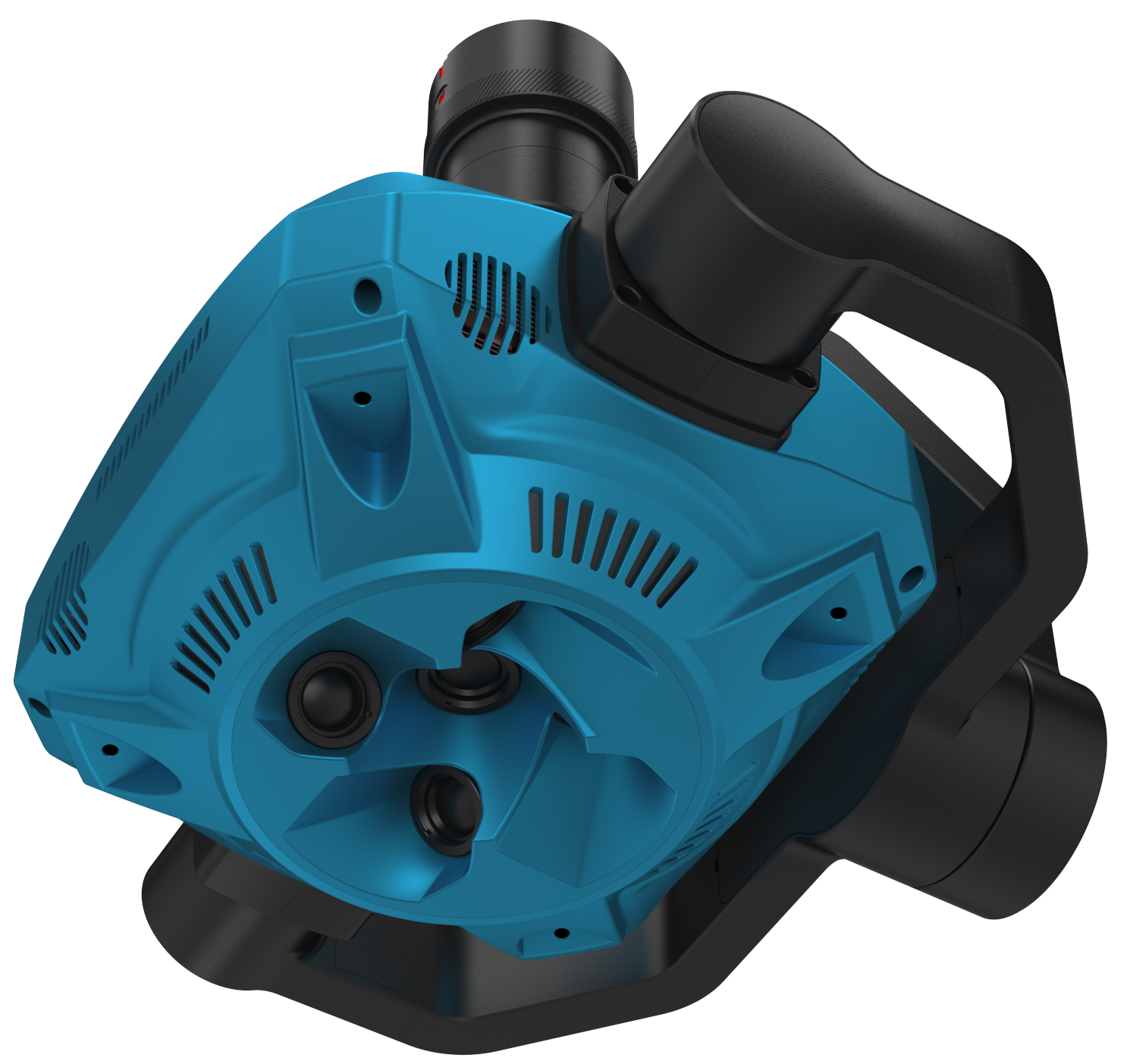
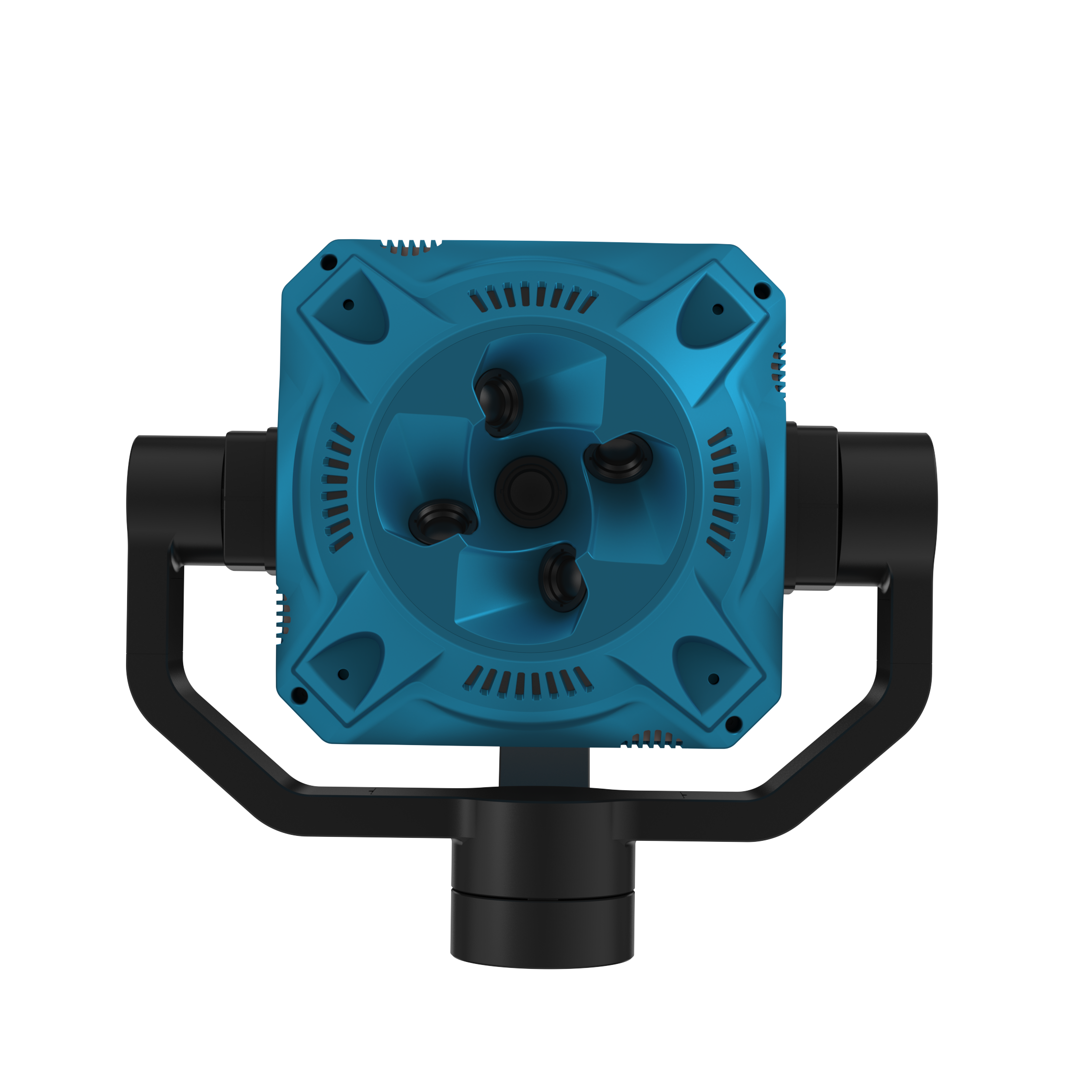
The ATL 102S V3 oblique camera uses a mechanical rig with five cameras in fixed positions in a cross configuration; one camera in the centre
is surrounded by four other cameras, front, back, left and right, equally spaced at 90-degree intervals.
This system positions the central camera at an oblique angle where the 'nadir' angle (the point directly below the camera at ground level) is at a known, fixed point in the frame
Advantages of oblique photography
Images captured with an angled camera (ATL 102S V3) reveal details that would otherwise have been obscured in vertical view by foliage or tall buildings.
Angled photography makes it easier to accurately determine the height of objects compared to vertical aerial photography. Unlike an orthographic setup, where the central camera looks straight down, the oblique system captures much more of the relative elevation data in front of it.
This also negates any lens distortion in all directions around the focal point, which the orthographic method often suffers from.
Using multiple shots with controlled intervals, the position and relative elevation information gathered from each dataset can be compared, contrasted, and then merged to give the relative elevation information between features in the target area, creating a map is created with both position and elevation data, which can be displayed as a 3D map of the surveyed area.
SPECIFICATIONS
Dimensions: 120*120*83 mm; 171*192*185 mm (with gimbal)
Weight: 1100 gram, incl. gimbal
IP class: IP5X
Operating temperature: -10 °C – 40 °C
Storage temperature:-20 °C – 50 °C
Power supply of camera extern: DC 12-50 V
Effective pixel single lens: ≥ 25 million pixels (125 million pixels in total)
Sensor size: 23,1 x 15,4 mm
Pixel size: 3,76 um
Image size: 6144 × 4096 px
Data storage: photo/POS file containing GPS information and camera parameter information
Focal length diagonally: 35 mm (normal incidence: 25 mm)
Oblique angle: 45 degrees
ISO-interval: 20, 040, 064, 080, 010, 000, 000
Shutter speed: 1/500, 1/640, 1/800, 1/1000 & 1/1250
Opening size: F 5.6
Storage capacity: The data storage module is pluggable and removable with a capacity of 1‘280 GB.
Operating mode: flight control trigger, isometric trigger & isochronous trigger
Stabilization: 3-Axes (Pitch, roll, yaw)
Rotation range of the gimbal: pitch: -120°-+45°, roll: ±45° & yaw: ±160°


