
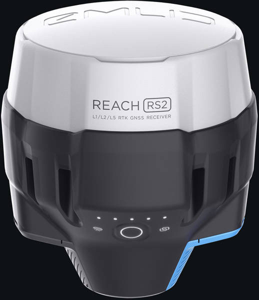

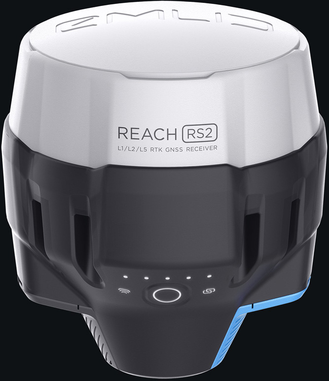
EMLID Reach RS2 - multi-band RTK GNSS receiver with centimetre precision
- For measurements, maps and navigation.
- Mobile application
- Baseline up to 100 km
- Update rate 10 Hz
Multi-band RTK GNSS receiver with centimetre precision for surveying, mapping and navigation with mobile app.
Base line up to 100 km
Update frequency 10 Hz
Improves in seconds
Reach RS2 gets a consistent solution in seconds and maintains robust performance even in challenging conditions. Centimetre accuracy can be achieved over distances up to 60 km in RTK mode and 100 km in PPK mode.
GPS, GLONASS, BeiDou, Galileo and QZSS
L1OF, L2OF, L1C/A, L2C, E1B/C, E5b, B1I B2I
PPP support
RINEX raw data logs are compatible with PPP services, so you can now get results with centimeter accuracy anywhere on Earth. Process RINEX files on the web service and get your position with absolute accuracy.
Built-in 3.5G modem
Reach RS2 is equipped with a low-power 3.5G HSPA modem with 2G backup and global coverage. Now corrections can be accessed or transmitted independently via NTRIP, without the need for an internet connection on your phone.
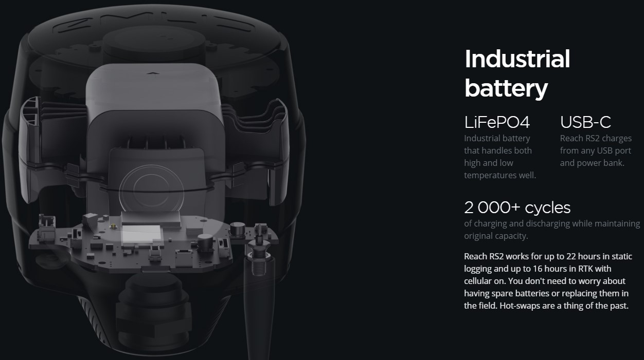
22 hours on a single charge
Up to 22 hours of autonomous operation when logging data and up to 16 hours as a 3G rover, even in cold weather - no more carrying spare batteries. Reach RS2 can charge from a USB wall charger or powerbank via USB-C.
Measurements with ReachView 3
The most user-friendly data collection software available for both Android and iOS. It supports thousands of coordinate systems and is translated into multiple languages. With ReachView 3 you can collect and plot points and control all Reach receiver functions such as base station configuration, RINEX data logging and NMEA output configuration.
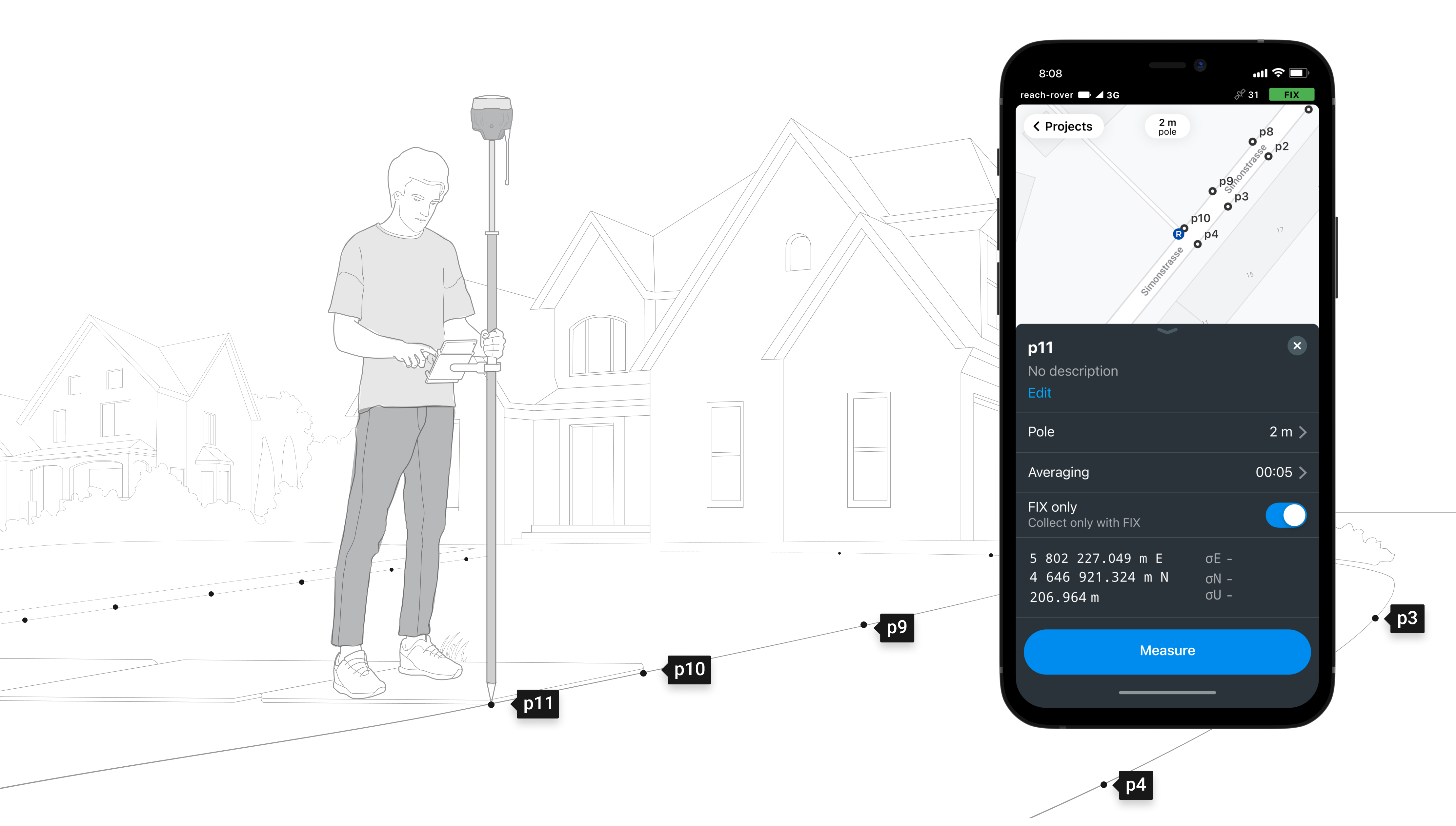
Collecting points : save points and export data to CSV
Save each item as a point with centimetre precise coordinates.
Export projects and open them in GIS or CAD software such as AutoCAD, ArcGIS, QGIS and others.
Coordinate systems based on: WGS84, NAD83, GDA2020 and others
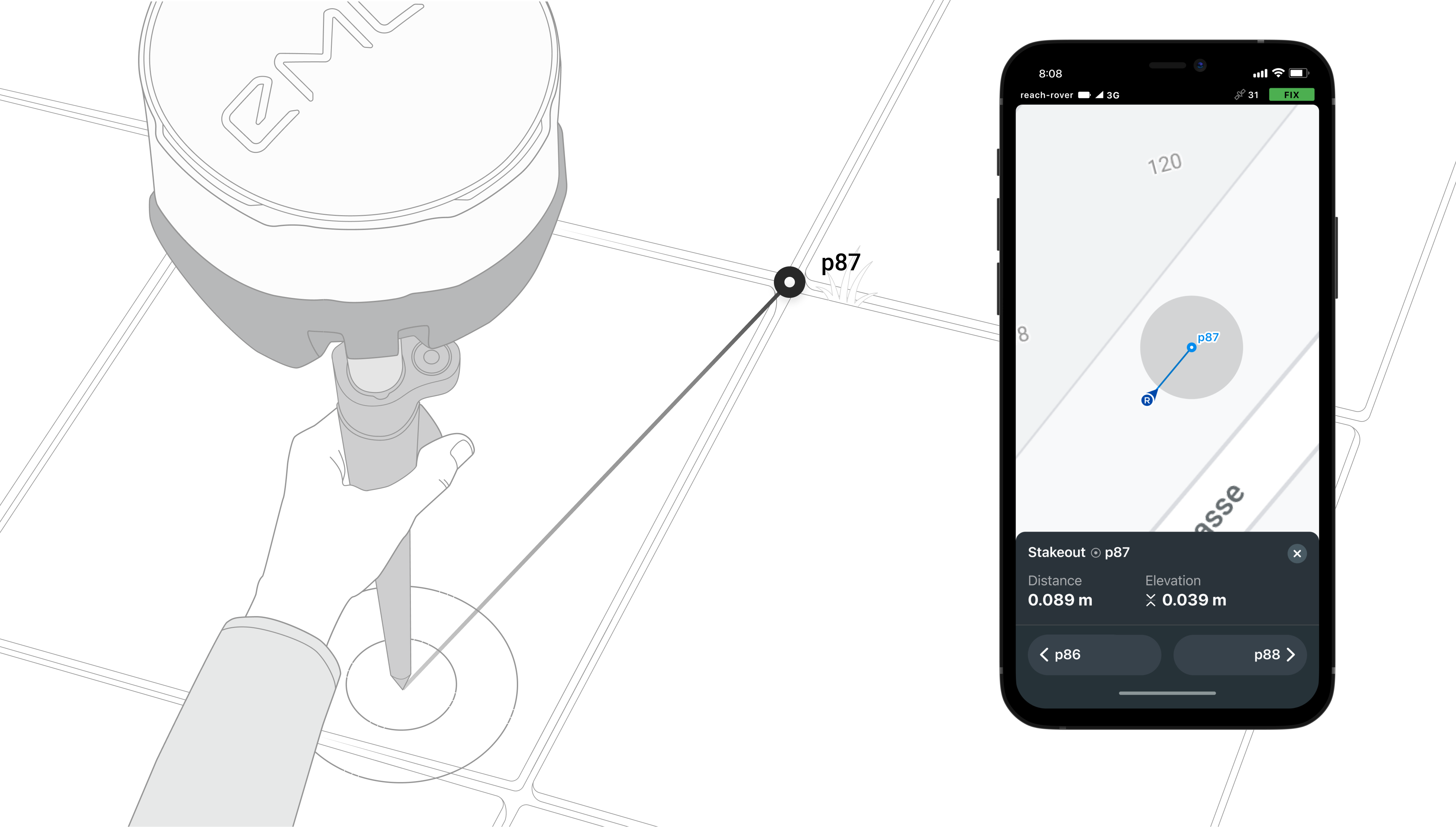
Marking out: find the position of a point on the ground
Pointing is used to find the exact physical locations of points. These can be collected in ReachView or imported from other CAD or GIS software.
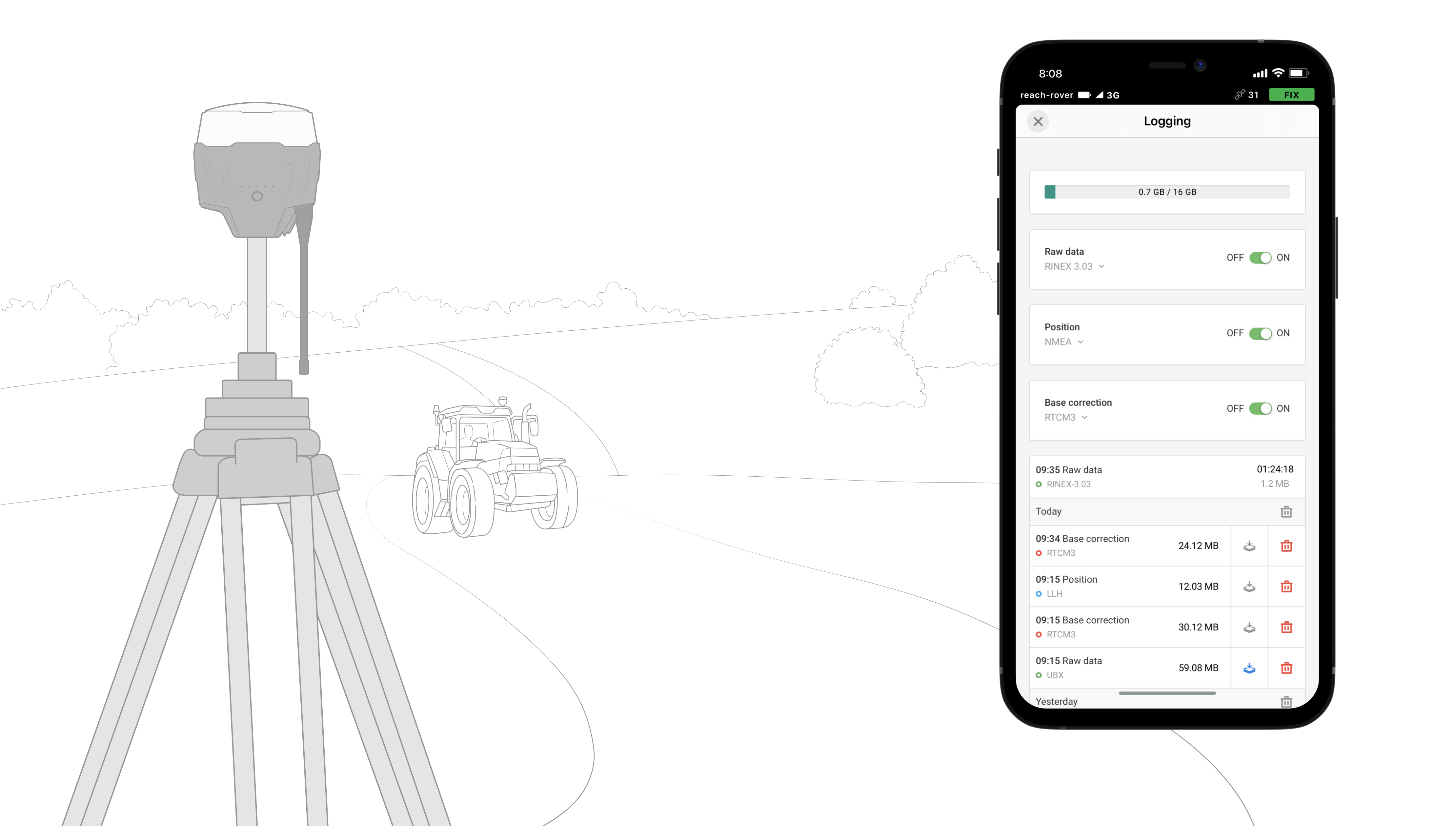
Logging in RINEX: record raw data, position and base correction logs. Log raw data, position and base correction logs. Point collection and RAW data logging are independent processes and can be used simultaneously. ReachView has a simple and intuitive interface for configuration and logging control.
We provide our version of RTKLib for PPK. It is free and can be downloaded from our documentation.
16 giga bytes
storage
160+ days
logging at 1 Hz
PPP for OPUS
RINEX raw data logs are compatible with PPP services, so you can now get results with centimetre accuracy anywhere on Earth. Process RINEX files on the web service and obtain position with absolute accuracy.
Connectivity, Real-time position streaming in NMEA
Reach provides data in the standard NMEA used by most GIS applications. Simply connect your device to Reach via Bluetooth or cable and enable "Position Output" in ReachView.
Reach can turn on and off automatically
Reach can turn on and off synchronously with an external battery connected via RS-232. This helps when the power button is difficult to access. For example, if the receiver is located on the roof of the tractor.
Compatible applications:
MachineryGuide, AgriBus-Navi, Efarmer, Agripilot and others
Position streaming
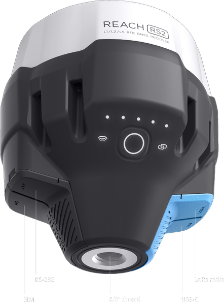
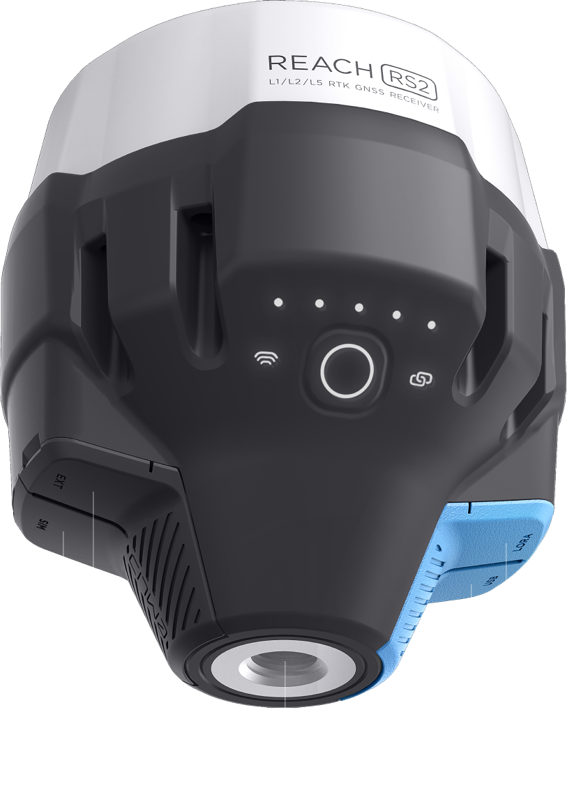
Interfaces:
RS-232, TCP, Bluetooth
NTRIP or other range as base station
Reach RS2 needs a base station as a correction source. This is a requirement for centimetre accuracy in RTK and PPK. The base station can be another Reach RS2 receiver or the NTRIP service. VRS is also supported.
Reach RS2 works seamlessly with other Reach receivers over any link
Interfaces:
TCP, LoRa, Bluetooth, RS-232, NTRI
Formats:
RTCM3
Maximum distance from base:
Over 60 km in RTK
100 km with PPK
Any place on Earth with PPP


CONTENTS OF THE PACKAGE
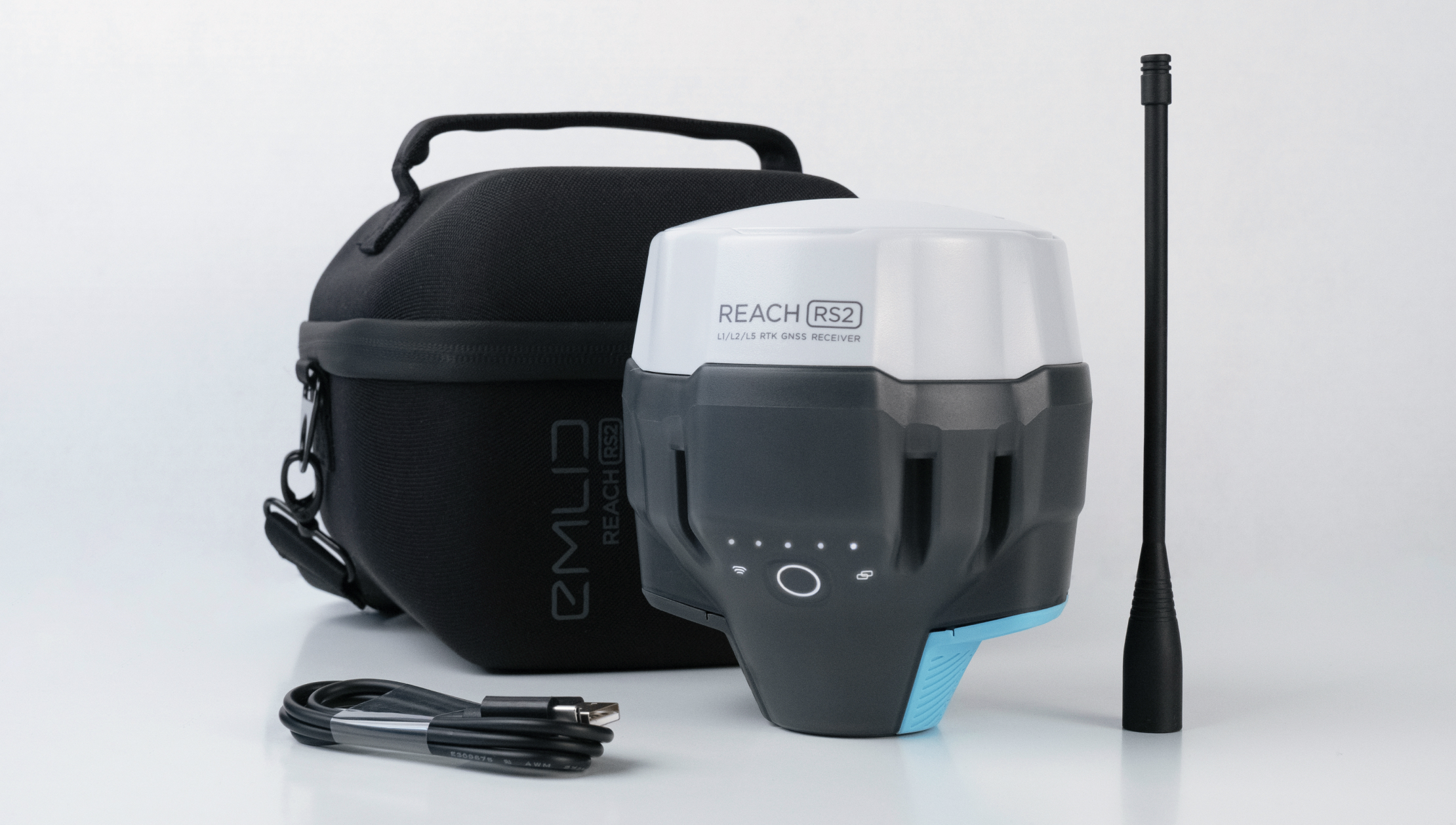
Included: LoRa antenna, USB cable and carrying case with strap
Reach RS2 is our biggest release since Reach RS
Emlid has delivered over 10,000 Reach RS RTKs worldwide
From America and Canada to Europe, Africa and Asia. We can't even count the number of ways people have used the Reach RS in their projects. Reach RS and Reach RS+ have given thousands of users around the world access to centimetre accurate RTK GNSS measurements.
With Reach RS2 we finally make multiband receivers available
Supporting multiple frequency bands, Reach RS2 fixes 10 times faster, operates on longer baselines and supports PPP processing. Reach RS2 can also provide centimetre accuracy in areas where Reach RS had problems: narrow city streets, forests and near buildings or machinery.
SPECIFICATIONS
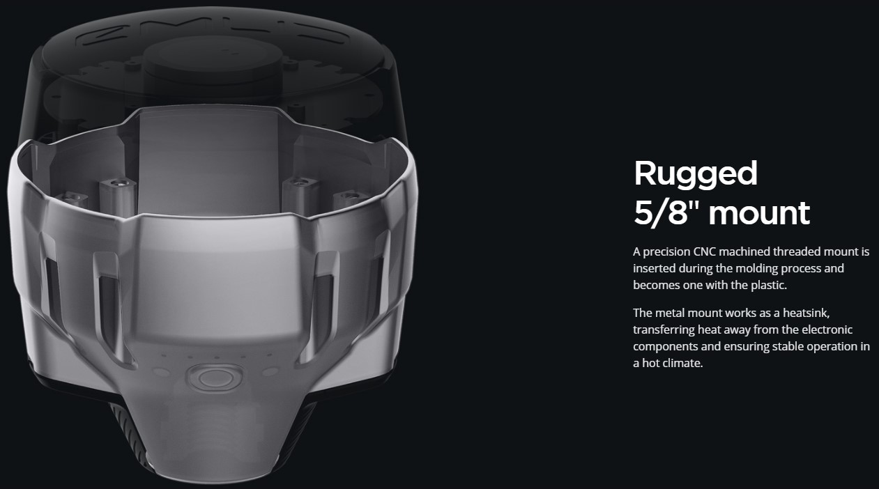
Dimensions: 126x126x142mm
Weight: 950g
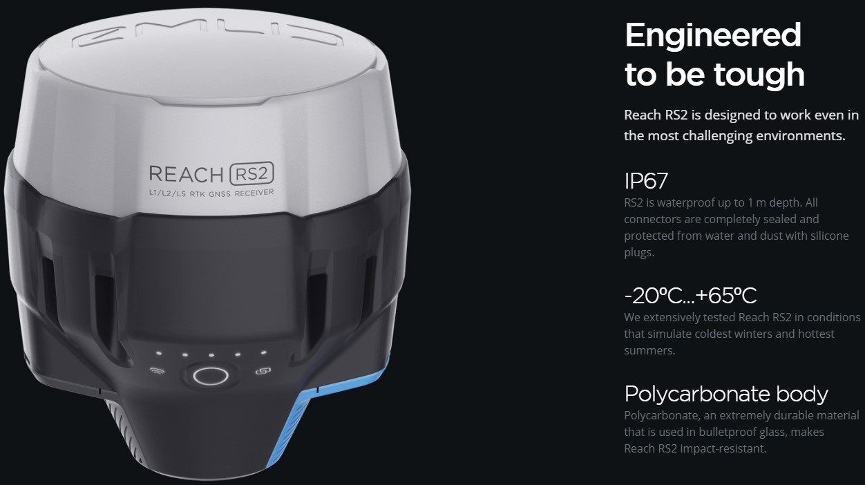
Operation: tº-20...+65ºC
Degree of protection: IP67 (water and dust)
Autonomy:16 hours as 3.5G RTK rover, 22 hours recording
Battery: LiFePO4 6400 mAh, 6.4 V
External power input: 6-40 V
USB charging type: C 5 V, 2 A
Regulatory: FCC, CE
Height: 4 mm + 0.5 ppm
Vertical: 8 mm + 1 ppm
PPK Height: 5 mm + 0.5 ppm
Vertical: 10 mm + 1 ppm
RTK Height: 7 mm + 1 ppm
Vertical: 14 mm + 1 ppm
Convergence time: ~5 s typically
Radio: LoRa
Frequency range: 868/915 MHz
Power: 0.1 W
Distance: up to 8 km
Modem: 3.5G
Quad-band bands: 850/1900, 900/1800 MHz
SIM card: Nano SIM
Wi-Fi: 802.11b/g/n
Bluetooth: 4.0/2.1 EDR
Ports: RS-232, USB type C
Corrections: NTRIP, VRS, RTCM3
Position output: NMEA, LLH/XYZ
Data logging: RINEX with events with update rate up to 10 Hz
Internal memory: 16 GB over 160 days logging at 1 Hz
GNSS
Tracked signal: GPS/QZSS L1C/A, L2C, GLONASS L1OF, L2OF, BeiDou B1I, B2I, Galileo E1-B/C, E5b
Number of channels: 184
Update Rates: 10 Hz GNSS, IMU9DOF